Introduction: Why Scan to BIM is Reshaping the AEC Industry
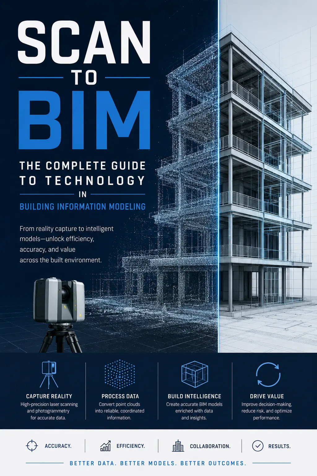
The Architecture, Engineering, and Construction (AEC) sector is undergoing a profound digital transformation. Among the most impactful innovations driving this shift is Scan to BIM (Building Information Modeling) — a methodology that converts real-world physical spaces into intelligent digital models using laser scanning and point cloud technologies.
As global construction projects become increasingly data-centric, Scan to BIM has emerged as a critical workflow for:
- Existing building documentation
- Renovation and retrofit projects
- Heritage preservation
- Facility management
- Industrial plant modernization
- Infrastructure digitization
- Digital twin development
According to market analysis from industry research platforms such as:
- https://www.grandviewresearch.com
- https://www.fortunebusinessinsights.com
- https://www.marketsandmarkets.com
the global BIM market is projected to exceed multi-billion-dollar valuations over the coming decade, with Scan to BIM services becoming one of the fastest-growing specialized segments due to demand for high-accuracy digital asset capture.
What is Scan to BIM?
Scan to BIM is the process of capturing precise physical site conditions using technologies such as:
- LiDAR scanning
- Terrestrial laser scanning
- Drone photogrammetry
- Mobile mapping systems
- Structured light scanning
The captured data forms a point cloud, which is then transformed into a detailed BIM model containing architectural, structural, and MEP (Mechanical, Electrical, Plumbing) intelligence.
Unlike traditional manual surveying methods, Scan to BIM dramatically improves:
- Accuracy
- Speed
- Spatial intelligence
- Clash prevention
- Lifecycle asset management
For BIM standards and interoperability frameworks, reference:
Core Technologies Behind Scan to BIM
1. Terrestrial Laser Scanning (TLS)
Terrestrial laser scanners emit millions of laser pulses every second to capture spatial geometry.
Key Benefits
- Millimeter-level accuracy
- Rapid large-area capture
- High-density spatial datasets
- Ideal for industrial and commercial facilities
Major Hardware Providers
- https://leica-geosystems.com
- https://www.faro.com
- https://www.trimble.com
- https://www.zeiss.com
- https://www.riegl.com
Impact
TLS significantly reduces field measurement discrepancies and minimizes rework during construction documentation and retrofit planning.
2. LiDAR Technology
LiDAR (Light Detection and Ranging) powers advanced spatial mapping workflows.
Applications
- Smart city mapping
- Infrastructure modeling
- Highway corridor scanning
- Airport digitization
- Utility network documentation
Enterprise Platforms
The integration of LiDAR with BIM creates scalable geospatial intelligence systems for infrastructure digital twins.
3. Drone Photogrammetry
Drone-based scanning accelerates data collection across inaccessible or hazardous environments.
Advantages
- Faster topographic surveys
- Reduced labor costs
- High-resolution orthographic imaging
- Safer industrial inspections
Industry Leaders
Photogrammetry is increasingly used alongside laser scanning to optimize large-scale Scan to BIM workflows.
Complete Scan to BIM Workflow
Step 1: Project Planning and Scope Definition
Before scanning begins, project stakeholders define:
- Level of Development (LOD)
- Modeling standards
- Required accuracy
- Deliverables
- Asset classification strategy
Common BIM Standards
- ISO 19650
- COBie
- IFC protocols
Reference:
Proper planning significantly impacts downstream modeling efficiency and data usability.
Step 2: Site Data Acquisition
Scanning teams collect field data using laser scanners and imaging systems.
Key Operational Considerations
- Scan overlap optimization
- Environmental lighting
- Reflective surface management
- Coordinate control systems
- Registration targets
Data Output
The result is a dense point cloud dataset typically stored in formats such as:
- .RCP
- .RCS
- .E57
- .LAS
- .PTS
Step 3: Point Cloud Registration
Individual scans are aligned into a unified coordinate system.
Registration Software
- https://www.autodesk.com/products/recap
- https://www.faro.com/products/construction-bim/faro-scene
- https://leica-geosystems.com/products/laser-scanners/software/leica-cyclone
Importance
Poor registration directly impacts BIM model integrity and downstream construction coordination accuracy.
Step 4: Point Cloud Processing and Cleaning
Noise reduction and segmentation improve dataset usability.
Typical Processing Tasks
- Outlier removal
- Object segmentation
- Surface extraction
- Color correction
- Density balancing
This stage significantly influences modeling productivity.
Step 5: BIM Model Creation
The processed point cloud is imported into BIM software for model reconstruction.
Leading BIM Platforms
- https://www.autodesk.com/products/revit
- https://www.graphisoft.com
- https://www.bentley.com
- https://www.nemetschek.com
BIM Components Modeled
Architectural
- Walls
- Doors
- Windows
- Floors
- Roofs
Structural
- Beams
- Columns
- Slabs
- Foundations
MEP
- HVAC systems
- Electrical conduits
- Plumbing networks
- Fire protection systems
Step 6: Quality Assurance and Validation
Model validation ensures alignment between the BIM model and captured reality.
QA Techniques
- Deviation analysis
- Clash detection
- Accuracy heat mapping
- Dimensional verification
Validation Software
Software Ecosystem in Scan to BIM
Autodesk Revit
Autodesk Revit remains the dominant BIM authoring platform globally.
Strengths
- Extensive BIM libraries
- Interdisciplinary collaboration
- Parametric modeling
- Large enterprise adoption
Integration
Works seamlessly with:
- Autodesk ReCap
- Navisworks
- BIM 360
Reference:
https://www.autodesk.com
Autodesk ReCap Pro
ReCap specializes in point cloud processing and registration.
Features
- Reality capture workflows
- Cloud indexing
- Scan alignment
- UAV integration
ReCap significantly streamlines preprocessing before BIM reconstruction.
FARO Scene
FARO Scene is heavily used for industrial and high-density scanning projects.
Key Advantages
- Automatic registration
- Large scan dataset handling
- Visual inspection workflows
Reference:
https://www.faro.com
Leica Cyclone
Cyclone is widely adopted for enterprise-grade reality capture management.
Enterprise Applications
- Oil & gas
- Industrial plants
- Smart infrastructure
- Transportation systems
Reference:
https://leica-geosystems.com
Bentley ContextCapture
Bentley offers strong infrastructure-focused reality modeling capabilities.
Best For
- Rail infrastructure
- Bridges
- Smart cities
- Transportation corridors
Reference:
https://www.bentley.com
Role of Artificial Intelligence in Scan to BIM
Artificial Intelligence is rapidly transforming Scan to BIM workflows from labor-intensive manual reconstruction into semi-automated intelligent modeling ecosystems.
AI-Powered Point Cloud Classification
AI algorithms can automatically identify:
- Walls
- Columns
- Pipes
- Ducts
- Structural members
Technologies Used
- Machine learning
- Deep learning
- Computer vision
- Semantic segmentation
Research Ecosystems
This dramatically reduces manual BIM reconstruction time.
Automated Object Recognition
Modern AI engines detect geometric patterns directly from point clouds.
Benefits
- Faster model generation
- Reduced human error
- Increased scalability
- Improved consistency
This is particularly valuable for large infrastructure projects and industrial facilities.
AI-Driven Clash Prediction
Predictive AI systems can identify coordination conflicts before modeling completion.
Advantages
- Reduced construction rework
- Improved scheduling
- Cost optimization
- Better lifecycle planning
Generative BIM Modeling
Generative AI is beginning to automate intelligent parametric reconstruction.
Emerging Possibilities
- Automatic wall extraction
- Smart MEP routing
- Structural reconstruction
- Parametric object generation
Industry Leaders Exploring AI-BIM Integration
Digital Twins and Scan to BIM
One of the largest future applications of Scan to BIM is the rise of digital twin ecosystems.
A digital twin combines:
- Real-time IoT data
- BIM intelligence
- Operational analytics
- Spatial simulation
Applications
- Predictive maintenance
- Energy optimization
- Facility lifecycle management
- Smart building automation
Platforms Driving Digital Twins
- https://www.microsoft.com/en-us/industry/manufacturing/digital-twins
- https://aws.amazon.com/iot-twinmaker
- https://www.siemens.com
Industry Applications of Scan to BIM
1. Heritage/ Existing Structure Documentation
Historic structures can be digitally archived with high precision.
Benefits
- Structural conservation
- Damage analysis
- Restoration planning
Organizations involved include:
2. Industrial Facilities
Scan to BIM is heavily used in:
- Oil refineries
- Power plants
- Manufacturing units
Key Drivers
- Retrofit accuracy
- Safety planning
- Operational continuity
3. Healthcare Infrastructure
Hospitals increasingly rely on BIM digitization for operational optimization.
Use Cases
- MEP coordination
- Emergency planning
- Facility management
4. Smart Cities
Urban digitalization initiatives are integrating Scan to BIM with GIS and IoT frameworks.
Strategic Advantages
- Infrastructure analytics
- Traffic optimization
- Utility management
- Urban resilience planning
Challenges in Scan to BIM Adoption
Despite rapid growth, several challenges remain.
High Initial Investment
Enterprise scanning hardware and software ecosystems require substantial capital investment.
Large Data Management
Point cloud datasets can reach terabyte scales.
Impacts
- Processing bottlenecks
- Storage costs
- Cloud infrastructure demands
Skilled Workforce Shortage
Advanced Scan to BIM workflows require expertise in:
- Surveying
- BIM modeling
- Geospatial systems
- Data analytics
Interoperability Issues
Cross-platform compatibility remains a challenge despite IFC standards.
Future of Scan to BIM
The future trajectory of Scan to BIM indicates accelerated convergence between:
- AI
- Robotics
- Cloud computing
- IoT
- Edge computing
- Digital twins
Industry forecasts suggest the next decade will witness:
- Fully autonomous scanning systems
- Real-time BIM updating
- AI-generated parametric models
- Continuous reality capture ecosystems
Strategic Business Impact
Organizations implementing Scan to BIM workflows are achieving measurable improvements in:
Operational Efficiency
- Faster project delivery
- Reduced field revisits
- Improved design coordination
Financial Performance
- Lower rework costs
- Better asset lifecycle planning
- Reduced construction disputes
Sustainability
- Optimized material planning
- Improved retrofit efficiency
- Better energy modeling